
Onetahua | Farewell Spit | Stone Scatter
Onetahua | Farewell Spit | Stone Scatter


Onetahua | Farewell Spit | Stone Scatter
A walk on Onetahua / Farewell spit. March 17 2026 as part of a survey looking for an invasive sea spurge.
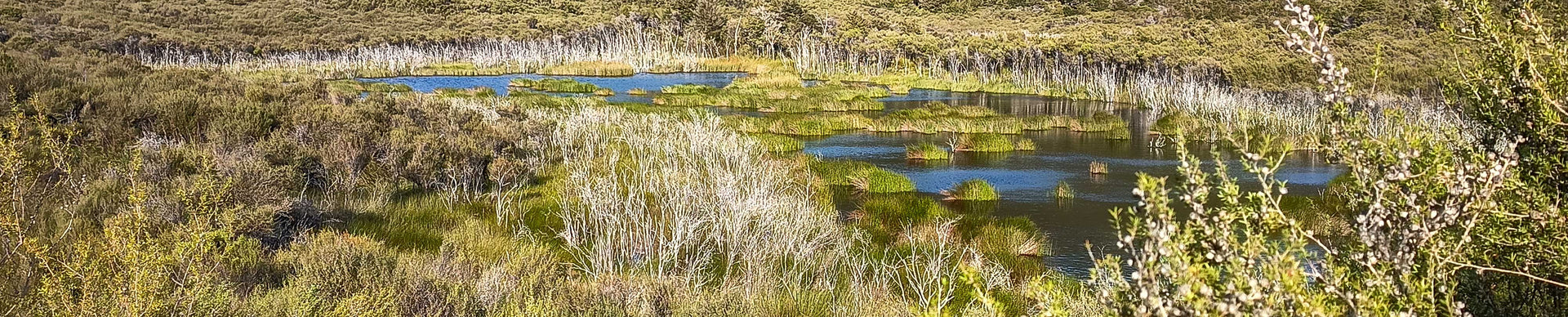
Amongst the deep sand dunes, small patches of exposed pebbles.
Eroded from the Southern alps, transported by rivers to the Tasman Sea, moved northwards along the West Coast by longshore drift with the Westland current and deposited on Onetahua / Farewell spit. The stone pebble patches are buried and then exposed by tidal surges.
Field data as inputs.
X Tidal Height
Y Wave Height
Z Pebble Size/ Transport Potential (Hjulstrom calc)
Stone scatter one; 60 stones
Simple three cell form. Two dominant openings with the third smaller offshoot cell, The shape suggests some tension between the larger cells with the third cell pulling with the curvature.
Stone scatter two:125 stones.
Multi cells overlap, four larger cells, a scattering of smaller cells. Tension here is less consistent. Multi directions are balancing each other.
Stone Scatter three : 155 stones.
Three or four larger cells form a flow of curves. Form is balanced by the anchor and appears to revolve around an axis.
7 — The artist’s will is secondary to the process he initiates from idea to completion. His willfulness may only be ego.
Kia ora,
below is my third iteration of a subject content statement. It references the finished piece which is still a work in progress. I think it completes the piece. I have enjoyed the challange here and I think it has some strength in the notion of using real ecological data to generate the initial points. A new development of my process.
A Grid
A collection of three photographs showing pebble scatters amongst drifting sand on Onetahua | Farewell Spit. Schist, greywacke and metamorphic rock ground down by glaciers and rivers and fed into the West coast longshore current system. Potentially in transit for thousands of years.
A statement of data sources. X - tidal height (m) range, Y - wave height Hs (m) range , z - Hjulstrom curve, theoretical plot of Pebble size/ transport potential in the West Coast current relevant to coarse pebble size. Data sourced from ecological tables tracking the movement of the pebbles from source in Southern Alps to deposition on the sandspit in the high tide storm surge area.
The artist has developed a virtual work system. Inputs, gathered data from the site. Source images, point arrays, stone counts, tidal height range, wave energy and pebble transport potential.
Images of three objects.
Three finished necklace pendants of the forms.
Images of Three Rimu Trees planted.
The elements form a grid of images, text and objects linked as a spatial representation. The temporal dimension is the implementation of the Hjulstrom formula to bring a time/movement.
Tension exists between the data and generated forms. Data, precise, numerical, measurable. The output form, organic, fluid, unpredictable. The data, strong association to a site. Output forms point to Onetahua, yet recorded as a reflection of the site and moment. A non site.
The fabricated pieces presented as three necklace pendant forms.
The artist plants three Rimu trees to finish the piece.
The grid is complete, reaching both directions on a time scale.